|
|
|
 |
 |
|
Location of Marina
Rouses Point, New York
Lake Champlain |
By water:
Going South:
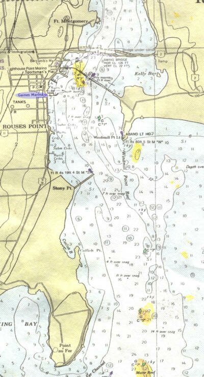
Check your chart.
From the Richelieu River by boat, after passing the Korean War Memorial bridge, between New York and Vermont (56' clearance), proceed through the abandoned railway trestle.
At the red buoy marker start turning to your right. We are the last marina of the group of marinas going south.
Going North on Lake Champlain:
Check your chart
From Lake Champlain: Proceed up the channel past the Stoney Point breakwater. Then pass Windmill point. Stay in the center of the channel. At the green buoy start turning left . The first breakwater going north is our marina.
We are BEFORE the abandoned railway trestle and the Korean War Memorial bridge.
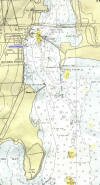
Click on the chart for a larger image with more detail.
|
|
| |
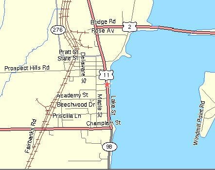
Rouses Point first settled in 1929 is located in Clinton County 27 miles North of Plattsburg, NY along Highway 223 beside Lake Champlain.
Rouses Point is less than a mile south of the Canadian border at the northern end of Lake Champlain. At nearby Island Point are the ruins of Fort Montgomery, which replaced Fort Blunder.
Vermont can be now be reached by the new Korean Veterans
Memorial Bridge which replaced the old one.
Important
This chart is for reference only.
It is not to be used for navigation.
|
By land:
Click here for Google Road Map
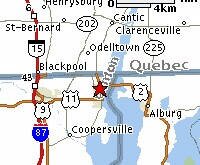 Going South: Going South:
We are about 50 minutes from Montreal. Take highway 132 south and then highway 15. After passing through customs at Lacolle, look for Rouses Point village on route 11.
Going North:
We are about 45 minutes from Plattsburgh. Take route 87 north and exit to route 11 east.
|
|
|
|